Home Case studies Everything about a Perth block, in one click
Case study · Property and planning
Everything about a Perth block, in one click
Buying, valuing or planning a Perth property means checking a dozen government websites. We built Keys to put the answers on one screen, with an AI assistant that only answers from that data.

The problem
A dozen websites for one address
Everything a buyer, agent or planner needs to know about a Perth block is public. It is also spread across more than a dozen agencies, each with its own map, format and login. Pulling it together for one address can take an afternoon, and it has to be done again for the next one.
Keys does that work once, for every parcel in Perth, and keeps it up to date.
- Landgate parcels
- ABS Census
- ABS SEIFA
- WA Police crime
- School catchments
- Transperth timetables
- Bushfire prone areas
- Landsat heat and greenness
- Satellite flood history
- Transmission lines
- Development applications
- OpenStreetMap amenities
- Childcare register
- Mobile and NBN coverage
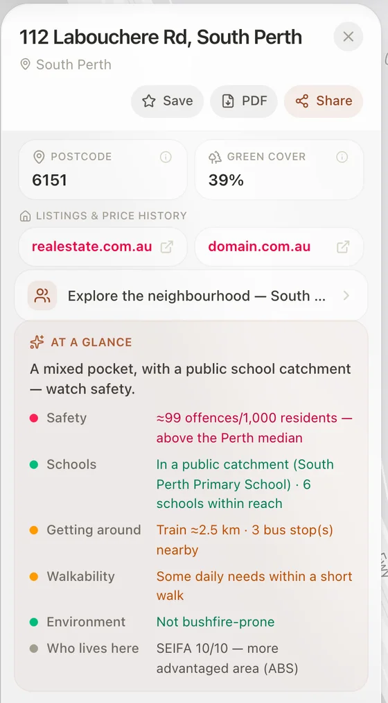
What one click shows
Real values for 112 Labouchere Rd, South Perth, as Keys showed them on 20 October 2026. Every line opens to its source.
People and safety
- Who lives hereSEIFA 10/10
- Safety and crimeTrend ↓17%
- SchoolsIn catchment
- Childcare1.4 km
Hazards and environment
- Bushfire proneNo
- Flood history (satellite)None observed
- Summer heat2.65°C cooler than metro
- Green cover39%
- Transmission lines66 kV · 34 m
Getting around
- Train2.5 km
- Traffic on the street10k / day
- Nearest beach5.1 km
- Airport11.6 km
Services
- Hospital emergency3.7 km
- Pathology595 m
- Shops and parks16 nearby
- Mobile5G, all carriers
- InternetNBN FTTP
Money and planning
- Running costs≈ $12.5k / yr
- Development applications1 current · $17M
- OutlookOpen · park 45 m
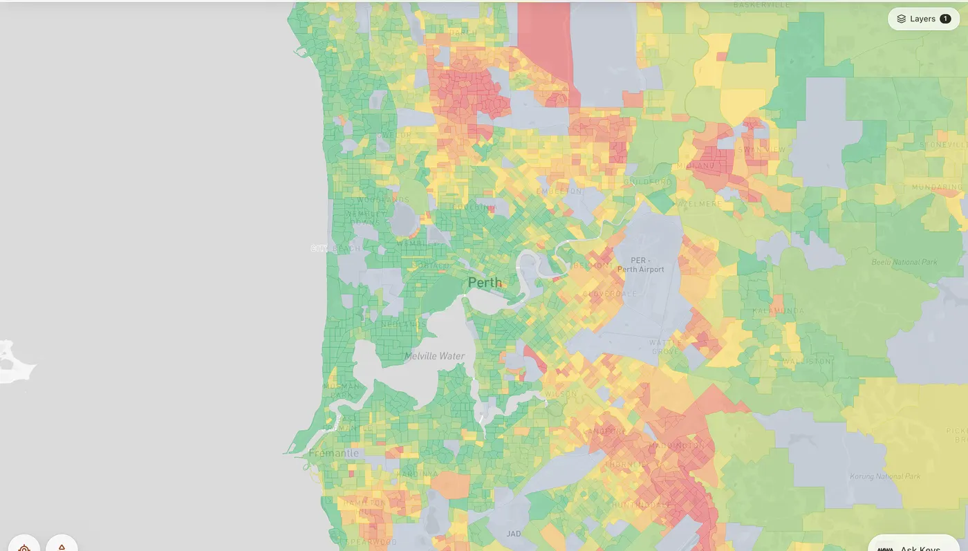
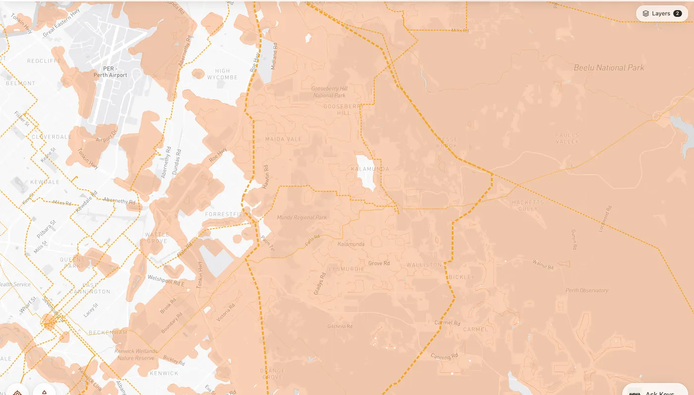
The whole city on the map
The same data as layers, so you can compare suburbs instead of reading one address at a time.
The assistant
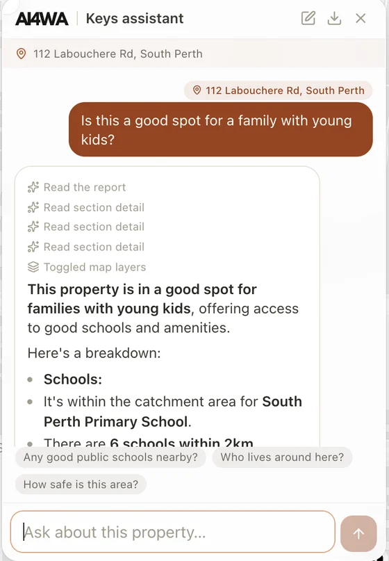
Ask in plain English. It answers from the data.
Ask whether a home suits a family with young kids, and the assistant reads the property's report first, then answers from it. It turns on the map layers that back up its answer, and suggests the next question.
- Grounded. It answers from the parcel database, not from general web knowledge.
- Shows its work. Each step is visible: read the report, read a section, toggled map layers.
- Honest about licences. Some WA layers, such as zoning and R-codes, are licensed and not republished. Keys links straight to the official viewer for those instead.
Who it helps
Keys is open to anyone in Perth. For property businesses, we build the same data and assistant into your own tools, on your data. More on AI for property and planning.
Agents and buyers' advocates
A due-diligence summary for any address in seconds, ready to share with a client.
Developers and valuers
Screen many sites against the same facts before paying for detailed reports.
Local governments
Answer resident questions with the same data planners use, linked to the official source.
Under the hood
Built to be checked
Every parcel sits in one spatial database. When you click, Keys joins it to each data set on the spot, so a full report takes about 80 milliseconds. Development applications sync every night from the state planning registers.
Every line in a report names its source and licence. Our own models add what no agency publishes: an outlook score for each parcel from 1 m elevation data, and summer heat from Landsat satellite images.
- Open WA and ABS datalicence tracked for every source
- Spatial databasejoins at query time, ~80 ms a report
- Nightly syncdevelopment applications from state registers
- Our own modelsoutlook from 1 m elevation, heat from Landsat
- Grounded assistantanswers only from the report and map
- Runs anywhereour cloud or your own servers
Keen to have a chat?
Schedule a coffee chat in Perth, an online meeting or an in-person meeting at your office. A rough idea of what you'd like to improve is plenty.